
The use of satellites and drones for mitigating the impacts of climate change within agriculture
-
 Email
Email
-
 Facebook
-
 Linkedin
-
 Twitter
-
 Whatsapp
28 June 2023
Agriculture is a vital industry that feeds the world's population. However, with increasing demand and population growth, farmers are facing pressure to produce more food with fewer resources. Fortunately, advances in technology have enabled farmers to improve their productivity and efficiency. One such technology is remote sensing, which uses satellites and drones to gather data and provide farmers with valuable insights into their crops' health and growth.
What is meant by the term remote sensing?
Remote sensing refers to the process of collecting information about an area from a distance without making physical contact with it. It is used for a wide range of applications, including agriculture, environmental monitoring, urban planning, disaster management, natural resource management and much more.
Origins
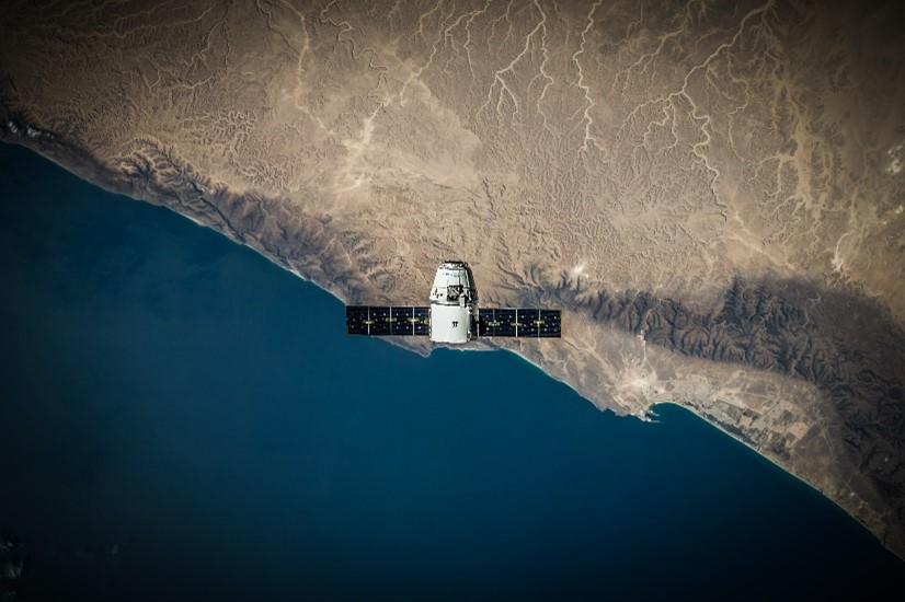
The history of remote sensing dates back to the mid-19th century, when aerial photography was first used for mapping and surveying purposes. The first known aerial photograph was captured in 1858 by Gaspar Felix Tournachon, a French photographer and balloonist. After 3 years of experimentation, Tourchanon successfully captured a photograph of the French village of Petit-Becetre from a hot air balloon, 80 metres above ground1. In the early 20th century, advances in technology enabled aerial images to be captured from aircraft, which became widely used for military reconnaissance during World War I.
In the 1960s, the first remote sensing satellites were launched by the United States, beginning with the first Landsat satellite in 1972. These satellites captured data using a variety of technologies, including optical and radar sensors. In the following twenty years, remote sensing technology continued to evolve with the development of synthetic aperture radar (SAR), a remote sensing technology that uses radar to create detailed images of Earth's surface, and global positioning system (GPS) technology which enabled more precise and accurate remote sensing measurements.
In recent years, the development of Unmanned Aircraft Systems (UAVs) such as drones, have led to a revolution in remote sensing allowing for more flexible and targeted data collection with a lower cost and higher spatial resolution.
What are the current challenges within agriculture?
Climate change
Climate change is having significant impacts on agriculture, both directly and indirectly. The rising temperatures, changing precipitation patterns, and extreme weather events such as droughts and floods are affecting crop yields and their quality, as well as the health and productivity of livestock. As the moisture levels increase along with temperature, pests and diseases become increasingly common, adding further stress to crops and livestock. Additionally, the altered climatic conditions brought about by climate change, including higher temperatures and shifting rainfall patterns, are creating more favourable environments for invasive pests and insects, increasing the risk and severity of infestations in agricultural areas as well as impacting the overall biodiversity.
It is also affecting the availability and quality of water for agriculture as water resources become scarcer and water quality is impacted by changes in temperature and precipitation patterns. This is particularly relevant for areas that rely on glacial meltwater, as glaciers are shrinking in many parts of the world due to rising temperatures. Furthermore, the changing climate patterns are leading to an increase in extreme weather events, including intense storms, hurricanes, and prolonged droughts, which can significantly disrupt the monsoon systems in affected regions. These disruptions further exacerbate water scarcity issues and pose additional challenges for agricultural practices reliant on consistent and predictable rainfall patterns during the monsoon seasons.
Biodiversity loss
In addition to these direct impacts on agriculture, climate change is also contributing to the loss of biodiversity. As habitats and ecosystems shift and change due to changing temperatures and precipitation patterns, many species are unable to adapt quickly enough and face increased risk of extinction. Biodiversity loss has significant impacts on agriculture as it can disrupt key ecological processes that support food production, such as pollination, nutrient cycling, and pest control. Take bees for example. It is estimated that 1 in 6 bee species is regionally extinct, and more than 40 percent are vulnerable to extinction2. If such beneficial insects and predators decline, there will be an increase in disease and pests, which will damage crops and yield. Biodiversity loss not only affects soil health but also disrupts the nitrogen cycle, leading to nitrogen pollution and its detrimental effects on agriculture and biodiversity. The Netherlands serves as an example, where excessive fertilizer use, and intensive farming have resulted in nitrogen deposition and subsequent restrictions on farming activities to protect ecosystems and restore balance3. To ensure sustainable agriculture, it is vital to address nitrogen cycle disruptions by promoting responsible fertiliser use, adopting agroecological practices, and protecting natural habitats.
Biodiversity loss can also affect the health and productivity of soil, which is essential for agriculture. Soil biodiversity, including microbes, fungi, and earthworms, plays a critical role in maintaining soil fertility, structure, and water-holding capacity. Loss of soil biodiversity can result in degraded soils that are less productive and require more inputs, such as fertilisers and pesticides, to maintain yields.
Furthermore, many plant and animal species are sources of genetic diversity that can be used to develop new crops and livestock breeds that are better adapted to changing environmental conditions. The loss of these species reduces the genetic pool available to agriculture, making it more difficult to develop resilient and adaptable crops and livestock.
Overall, biodiversity loss is a serious threat to agriculture and food security, and it is essential to protect and restore biodiversity in agricultural landscapes to ensure sustainable and resilient food production systems.
Population growth
The growing global population is having a significant impact on agriculture, both in terms of the demand for food and the pressure on the natural resources required for food production. Population growth it rapidly accelerating globally, it’s expected to grow to 9.7 billion by 2050 and it could peak at nearly 11 billion by 21004 (United Nations, 2019).
To meet the growing demand for food, agricultural production has intensified, resulting in larger farms, increased use of agrochemicals, and a shift towards high-yielding crop varieties. While these practises have increased the overall productivity of agriculture, they have also resulted in environmental degradation, including soil erosion, water pollution, and loss of biodiversity.
Currently one third of people globally suffer from some form of malnutrition5, and the growth in population may not only lead to food insecurity but also more greenhouse gas emissions and environmental degradation. It is placing huge pressure on natural resources such as land, water, and energy, which are essential for agricultural production. It is likely that there will be competition for land, which will cause conflict between agriculture and urbanisation. As a result, there is a need for sustainable agricultural practises that ensure the long-term viability of natural resources and support the growing demand for food.
In order to mitigate these effects, sustainable agriculture practises can include precision farming, which uses technology to optimise inputs and reduce waste, conservation agriculture, which focuses on maintaining soil health and biodiversity, and agroforestry, which combines crops and trees to provide a range of benefits such as soil conservation and carbon sequestration.
How can remote sensing help?
Remote sensing can provide valuable insights to farmers and agricultural stakeholders, helping them to make more informed decisions about crop management and land use practises. The data collected through remote sensing can be used to develop more accurate and reliable models of crop growth and health, allowing for more targeted and efficient use of inputs such as water and fertiliser. This can help to reduce waste and increase yields, while also minimising the negative impacts of agriculture on the environment. According to the Agricultural and Horticultural Development Board6, satellites play a crucial role in modern agriculture by providing valuable information and insights that can aid in:
- Detecting and controlling pests and disease
- Understanding water and nutrient status
- Planning crop nutrition programmes
- Informing in-season irrigation
- Predicting yields
- Estimating harvest timing
What sensors do satellites have?
There are many types of sensors used on satellites, though the most commonly used within agriculture are:
- Multispectral Sensors: Multispectral sensors capture data across multiple discrete spectral bands, typically including the visible and near-infrared regions. These sensors measure the intensity of reflected sunlight in different spectral bands to identify vegetation patterns and characteristics. Multispectral sensors are used for crop health monitoring, pest and disease detection, vegetation index calculation, and land cover mapping.
- Hyperspectral Sensors: Hyperspectral sensors capture data across numerous contiguous spectral bands, providing more detailed spectral information compared to multispectral sensors. These sensors measure the intensity of reflected or emitted light across narrow and contiguous spectral bands, enabling precise spectral analysis. Hyperspectral sensors are utilised for precise crop classification, nutrient content assessment, disease identification, and detailed vegetation analysis.
- Thermal Infrared Sensors: Thermal infrared sensors capture thermal radiation emitted by objects, including crops and soils, to assess temperature variations. These sensors detect and measure the long-wave infrared radiation emitted by objects based on their temperature. Thermal infrared sensors aid in monitoring crop water stress, estimating evapotranspiration rates, identifying irrigation needs, and detecting anomalies related to plant health and temperature.
- Microwave Sensors: Microwave sensors measure microwave radiation that interacts with objects, providing information about various properties such as soil moisture content. These sensors emit microwave signals and measure the reflected or transmitted signals to analyse specific properties of interest. Microwave sensors are used for soil moisture mapping, monitoring drought conditions, assessing soil composition, and analysing vegetation water content.
This is only a selection of sensors which are commonly used for agricultural purposes, a full range can be found on the NASA website7
How can they help agriculture?
This is made possible through a use of different sensors. Let’s break this down.
Detecting and controlling pests and diseases: Satellites equipped with multispectral or hyperspectral sensors are used to capture high-resolution images of agricultural fields. These sensors detect electromagnetic radiation across different wavelengths, allowing for the identification of specific vegetation indices and patterns. By analysing these images, farmers and agricultural experts can identify areas affected by pests and diseases, enabling early detection and targeted control measures.
Understanding water and nutrient status: Satellites equipped with thermal sensors and microwave radiometers can assess soil moisture levels. These sensors measure the temperature and water content of the soil, providing insights into the water status of crops. Additionally, multispectral sensors can assess vegetation indices related to nutrient content and health. By combining these measurements with crop models and ground-based observations, farmers can optimize irrigation practises and adjust nutrient application to meet crop requirements.
Planning crop nutrition programs: Satellites equipped with multispectral or hyperspectral sensors are used to monitor vegetation indices related to nutrient content and health. By analysing the reflectance of different wavelengths of light, these sensors provide information on plant nutrient status. Combined with ground-based observations and crop models, this data helps farmers develop precise crop nutrition programs, ensuring optimal fertiliser application to maximise crop health and minimise environmental impact.
Informing in-season irrigation: Satellites equipped with thermal sensors and microwave radiometers can assess crop water demand by measuring evapotranspiration rates. These sensors detect the amount of heat and moisture released by crops into the atmosphere, providing insights into water usage. By monitoring crop water demand throughout the growing season, farmers can make informed decisions regarding irrigation scheduling and water allocation, improving water use efficiency.
Predicting yields: Satellites equipped with multispectral or hyperspectral sensors continuously monitor crop health, vegetation density, and growth patterns. By analysing the reflectance of different wavelengths of light, these sensors provide information on crop productivity and potential yield. Combined with ground-based observations and crop models, this data helps farmers estimate yields, enabling effective planning for harvesting, storage, and market strategies.
Estimating harvest timing: Satellites equipped with multispectral sensors can assess crop colour and ripeness. By analysing reflectance in specific wavelengths, these sensors provide insights into the maturity and readiness for harvest. This information helps farmers determine the optimal timing for harvesting, ensuring crops are harvested at their peak quality and reducing potential losses.
What does the future of remote sensing and agriculture look like?
The future of agriculture and remote sensing holds great potential for further advancements and applications.
Satellites and drones are expected to continue to improve their imaging capabilities, providing higher spatial and spectral resolution. This will allow farmers to gather more detailed and precise information about their crops.
In addition, it’s likely that there will be more integration with AI and machine learning algorithms. This will automate tasks such as analysing collected data through remote sensing. For example, these technologies could automate the detection of crops, pests, and disease.
Finally, it’s likely that we will see an increase in the accessibility and affordability of satellite and airborne imagery. As remote sensing continues to evolve alongside current threats to our climate, remote sensing tools are becoming more accessible and affordable for farmers of all scales. This includes the availability of low-cost drones equipped with sensors, as well as the provision of satellite data through open data initiatives and commercial services.
Aaliyah Pollock
Data and Tech Analyst
2https://www.biologicaldiversity.org/campaigns/saving-the-insects/native-bees.html
4https://www.un.org/development/desa/en/news/population/world-population-prospects-2019.html


